Wednesday, June 30, 2010

With so much windshield time, crazy things pop into my head...


As I was driving to Moab, UT today, I was going through the postings in my head and sure enough as I look at them this evening, I forgot to include the pictures from the Confluence Tower looking at the Mississippi and Missouri rivers.

The first place I was trying to get to was under water.
Looking at McNally's maps, I found a site in Illinois that turned out to be Fort DuBois where the Corps of Discovery started their journey.

On my way around the river, I crossed in Alton, IL and headed south towards St. Lou. As I was passing the Confluence Tower where I would eventually wind up, I saw this huge vehicle moving a set of pipes. It turns out there were 5 of these pipe sections delivered for a refinery near by and due to the rising Mississippi, they were being moved to higher ground. Turning the corner was fun to watch. Most interesting is the fact that the "driver" was a man walking behind the vehicle using a joy stick to controll all of those axles under this thing. Amazing.
Finally headed to Fort DuBois. There was a nice museum and a replica of the Fort that the Corps of Discovery built before their launch up the Missouri. While at the museum I found about the Confluence Tower which had been open for less than 3 weeks. My good fortune.

The middle trees where the rivers come together is where I was originally trying to get to. If you click on the picture and make it bigger, you can see that the trees are in the water.
Finally are the pictures of the wild toads of the Confluence Towers.

I hope I have not missed any other pictures that I spoke to in the blog. Let me know if there is any other place or picture that I missed.

Also, as you can imagine, I have many more pictures than what I have posted. I will find a place to post many more of the pictures later in the summer after I return and recuperate a bit.

Thanks for coming along on my journey. For the first time I am staying in one place for 3 nights - Moab, UT. There are a couple of National and State Parks, National Monuments and Scenic Byways that I want to visit. The drive to the KOA and into Moab itself is beautiful! I can't wait to get up and get moving. But until then, here are the pictures I missed and I will follow with another post or two as well.

Michael

Tuesday, June 29, 2010

Kansas City, Kansas City here I come...


Had a good day today visiting some Indian ruins and the setting for Saturday afternoon Movie Westerns, but the cap on the day was attending a Ro-day-o. The 2010 Junior National Rodeo is being held in Gallup, NM this week.


Junior in this case is 6th, 7th, and 8th graders from across the US with some participants from Canada and Australia. There are 48 states represented (missing Alaska and New York of all places). The boys even ride bulls. No bucking broncos but real bulls. They may be junior bulls, but they have horns and are mean just like their daddies! Crazy!!


We were leaving Jefferson City, MO as we fell asleep last night. We are headed for Jefferson City, MO to visit the headwaters of the Pony Express. As you may recall, whilst I was visiting Sacramento, CA to take pictures of the Capitol building, I stopped by Old Town and snapped some shots of the end of the line for the Pone Express hoping that I would get to stop at Jefferson City to see where it all began.


On the way to Jefferson City, MO, kinda on the way, is Brunswick, MO and Sumner, MO. two glorious locations smack dab in the middle of no where. But they do have some special attractions.


Brunswick caught my early in the planning stages for my little journey. It just so happens to have the "World's Largest Pecan". Since I did not know that they grew pecans in Missouri at the time, I had to find out why they would have the world's largest and why did it not grow old and wither away like all the other pecans that fall onto the ground.


It turns out that this part of Central Missouri is big into pecans and into big pecans in general. The World's largest it turns out is made of concrete and in need of a touch up paint job, but it is in relatively good condition. On the property near the pecan was a bench memorializing the late owner of the pecan ranch on his 1999 demise. I would imagine that the world's largest pecan will slowly weather away. It is 11,000 pounds of concrete and does not look a pound over 8,000.


After nearly getting creamed by a speeding truck due to missing the turn-off to the pecan, it was off to Sumner, MO and the world's largest goose. Why Central Missouri is entitled to two such fine specimen of the USAs most enduring folk art I don't know. But here they are.


Brunswick is the place that I was alerted to the bridge being out at the main turnoff. This is the only place where I have had such notice. Like today's big disappoint that you will hear about in a later posting where I did not find out until I arrived at THE spot I was driving to, to find out it was closed. Thank you Missouri for the notice.


Next to the Sumner Goose was a cemetery. In the cemetery was this monument to the war dead of the US. Not for any war but all the wars. I have noticed these monuments in most of the towns on the highways and byways of my excursion. I would suppose they were started from one of the more recent wars whether Viet Nam or later and then all the casualties are memorialized. Small towns - the backbone of America. But why these places exist escapes me sometimes.


While driving to Sumner, I passed road signs warning that the roads flood in heavy rains and not to drive through the flooded roads. This means many miles of alternate routes each rainy season. Sumner was a grocery store, a closed gas station and a dozen houses. I am sure it was there to support the many farms in the area, but why live in Sumner, MO - especially if you have to drive many miles out of your way when it rains. What ever.


Since I was in the area I went in search of the Locust Creek Covered Bridge. There are many covered bridges in Indiana, Illinois and Missouri but I was not near one when I had the time to stop so off I went. Here is where the Rand McNally failed me again.


Not having a more detailed map of the area, I knew there had to be a sign directing me, but I was unsure of which county lane would have the sign. I drove in a big square getting more frustrated by the minute but also becoming more stubborn about finding it - it must have been the heat. But after finding it, I was humored by the fact that there is no water under the bridge. There is a sign that says that Locust Creek used to be here, but it moved near the parking area and the Locust Creek Bridge stands where it was built instead of being moved to where the Creek now flows. I also liked that they have put in pipes to a water hydrant in case the bridge catches fire. Not that anyone could get to the bridge in time to put out a fire, but I suppose part of the bridge would be saved. Then maybe they would move the remaining original pieces to the current location of Locust Creek. :)


Back on the road to Jefferson City. Burning daylight, there I go getting behind schedule again. Speaking of which, while driving down the road I passed the Chillicothe Airport. Not that the people of Chillicothe need an airport in and of itself, I suppose it serves the crop dusters as well as the private planes in the area.


I have discovered what the US Military has done with much of their out of date equipment. Many small towns have a piece of large retired war machinery. It can be a tank, or an anti-aircraft gun or a Blackhawk helicopter line in Vernal, UT, the Chillicothe Airport has this war bird. This is one airport that you do not overlook.


Before even getting to the world's largest pecan, I spied along the road what may be the world's largest grasshopper being chased by an alligator. This time there was no truck to run me down, but I still had to double back as I was not expecting these fine specimen of metal smithing along the backwater Missouri Highway 24 just outside Moberly. But these are just another reinforcement of why I am taking this journey. I should be filming this and then I could turn it into a travel show. Then I could have written the whole thing off and stayed in much better accommodations. I guess that is just like having a premonition of the bombing of Pearl Harbor on December 8th.


Finally making it to Jefferson City, only to find the museum was already closed for the day. Why do museums and tourist attractions close at 5 PM. Even the San Francisco Museum of Modern Art closed at 5 so it is not just small town America. I guess it is the visitors that originate in small town America that like to have supper at 5 or 5:30 that go back to their hotels and get ready to eat. Just one of those things that make me go - hmmm, I wonder why...?


Across the street from the Pony Express Museum is a stone marker showing where the riders left for Sacramento. While looking for a store to but some water and post cards, I found the large statue that mimics the one in Old Town Sacramento. There were no stores in the old section of Jefferson City where the Pony Express began. Nor were there any downtown near the larger statue. I had to go to the "beltway" to find a Walgreen's and a CVS. When looking for post cards, don't bother with CVS. Having searched in three different cities I now know to find a Walgreen's - have been successful each time.


To top off my being so late to getting to Lawrence, KS and bedding down for the night. Interstate 70 in Eastern Kansas is a toll road. No notice until you see a sign that says "Last Free Exit". uh oh. I seem to recall seeing this was a toll road, but at 9 PM, the details escaped me. On we go to the exit - which is closed due to road construction. Not only is it dark and I have never been to Kansas before, the State has added to its coffers by forcing me to take the next exit. You know that it cost more money for going 1 more exit. What a great way for the state to raise additional money from the toll roads - just randomly close an exit and force people to use the next one and pay an extra quarter. That would add up fast. I will have to pass this on to Arnold. It can be his lasting legacy for California - change the major North/South arteries to toll roads and have random exit closures.

Finally made it to the KOA. The money changer at the next exit had locations pre-programed into the computer for directions. At least Kansas thought that far ahead. Maybe it was because I was in Lawrence the location of the University of Kansas. With so many out of town people needing to get to the school for sporting events, graduation and such they thought enough to have the money grabbers have access to directions. And technically they were correct if not a tad misleading.

The directions to the KOA from the next exit appeared easy enough - three right turns. Just follow the yellow brick road, make three right turns, and you appear at the KOA. No where in the directions did it state that the highway through the streets of Lawrence turned left. Thank you very much. Of course the part of town I found myself was the restaurant and night club district - must have been near the campus - with mostly one-way streets. Like a good boyscout, I found my way. Lewis and Clark have nothing on my when it comes to finding my way - except in Hong Kong.

Found the yellow brick road again and made it to KOA. Was eaten alive by the mosquitoes while setting up the tent, but what a small price to pay for such a wonderful Shang-ri-la. Not even one complaint for my hammering in tent stakes or using a battery operated pump to blow up the air mattress at 11 PM. It also helped that I was the only tenter in the place and on the other side of the kampground from those lackeys in their road blocking moving houses.

I have found the larger the motor home the better the driver. It must be if you can drive a bus sized vehicle, with a car in tow you either are good at it or you have an accident every time you turn a corner. Now those small, self contained, over sized truck campers - get as far away as quickly as you can. Be afraid, very afraid.

thanks for coming along with me. Next stop will be Dodge City, well the next targeted stop is Dodge City - there will always be some exciting place along the way to investigate.

Michael

Monday, June 28, 2010

On the Trail of the Missouri River...


Good morning campers!

Had a good night - no rain. The birds are a natural alarm clock. Glad that I want to be up so early - otherwise they would be a pain for waking me up so early. :)

I want to go see where the Missouri enters into the Mississippi to come full circle with the river. I originally wanted to get to the headwaters of the Mississippi in Northern Minnesota, but it was just too much to add another 6 or 7 hours to get home to Indy so I just had to see the Missouri to its conclusion.

Well, the info sign pointing me in the direction to the State Park for the confluence of the two great rivers left a little out in the middle of the route. But perseverance and checking another map got me back on track. This park is on the tip of an island that sits between where the Illinois River enters the Mississippi and then where the Missouri mixes with the Mississippi at the other end of the island. It is across the Mississippi from Alton, IL. (May be familiar to those who follow Good Eats on the food channel.)

Like Lewis and Clark, showing much perseverance, I find the correct path to the confluence. The weather does not cooperate. Seems that all the rain that has been following me has flooded the low lying areas around the great rivers - the park is closed due to flooding. Great.

Looking at the map, I spy a location in Illinois across from the confluence of the great rivers - Fort Dubois - the starting point for the Lewis and Clark Expedition. Off we go to Alton, IL and south to Fort Dubois.

Along the way I find this huge piece of piping being moved from the river where it was taken off a barge to higher piece of land in case the mighty Mississippi decides to go exploring on its own. This is the 3rd of 5 pieces of the same size that are being moved. This huge structure is being "driven" by a man with a joy stick walking behind the moving structure. It was fun to watch this structure turn the corner. American engineering ingenuity.

On to Fort Dubois. The location of the Center is on the other side of the levee from the river, so the replica of the Fort and the Center itself are dry. However, the monument across the Mississippi from the confluence with the Missouri is flooded. Now I begin to start to get concerned. I start to look at the levees to see where I might hike to so I can get a picture.

Ah, I'd rather be lucky than good some times - and in this case I am. If just so happens that the floods of 1994 flooded out another monument marking the confluence of the great rivers on the Illinois side so money was raised for a tower that is 150 feet and looks over the levees. It is having its soft opening and had its Corps of Discovery users June 3. I am in luck.

A short elevator ride later - dot da da da - eureka - a confluence!

Inside the little visitor center they have a relief map of the area that is about 15 feet wide. There are 3 flat panel screens about the relief map. In front of the map are series of buttons numbered 1 - 15 from left to right. Problem is the numbers 1 - 15 on the relief map start right to left. The short video pieces show the appropriate video when the button is pushed, you just can not see where the area is that is being discussed on the video since it is on the other side of the map. That is what soft openings are for.

After the ride up the tower to see the confluence of the great rivers, two little girls visiting with their grandfather found a bunch of toads. One of them would scream and drop the toad every time the toad moved and then she would pick it right back up. Just some of the wildlife I have seen on my journey. The toads were funny as well.

I am on my way to Lawrence, KS for the evening. Jefferson City, MO is on the way so getting pictures of the Capitol will be easy and not too time consuming. But a stop before the Capitol is warranted. On the good ol' Rand McNally in the alerting red print are the words Winston Churchill Memorial.

Having a memorial to Churchill is a natural thing to have somewhere in the US. He was a great world leader and is deserving of such an honor. But why in the middle of no where Missouri?

It turns out that a small college - Westminster College- in Fulton, MO invited the Prime Minister to speak. The invitation was routed to President Truman as well. Truman added a personal note stating that the small College was in his home state and he would attend the ceremony as well. Churchill accepted after seeing Truman's note and gave one of his most important speeches on the Cold War at this tiny college in the middle of no where Missouri.

It is fine museum that chronicles Churchill's military and political life. It includes some captured Nazi video as well other original items. It has some of Churchill's cases that he used during his time of Prime Minister. One can only guess what important dispatches were carried in those cases. The museum is significantly better than the Mark Twain museum in Hannibal. If you ever find yourself driving along Interstate 70 in the middle of Missouri and find yourself with an extra hour or three, it is worth your time to stop.

The museum has the original letter with Truman's hand written note to Churchill. They also have a sizable piece of the Berlin Wall to go along with the theme of his speech. All in all a nice find along the way from Indy.

Moving on to Jefferson City to get some pictures of the Capitol, I happened upon a race of solar powered cars. The cars are mostly from US Universities with a few international entrants. The race is called 2010 American Solar Challenge. Good timing once again in that I was there about 15 minutes when the Stanford entry arrived. Jefferson City was the half way point for that day's drive.

The University of Michigan entry won for the 6th time of the 10 years of the race. UM also came in 3rd in the Australian Solar Challenge. Their car could attain speeds of 100 mph. The poor drivers have very little ventilation. They look like prairie dogs sticking their heads out of their burrows as the driver looks out of a bubble in the middle of a sea of solar panels. Stanford's driver headed for the nearest fountain to try to cool off. It was very hot that day and with such little ventilation in the cars due to weight considerations, I am surprised the drivers don't pass out from heat exposure. But they are young college students having their own Corps of Discovery moment.

Finally there are the pictures of the Capitol Building and a replica of the Liberty Bell that is on the grounds.

Thanks for traveling along. The next post will continue the trip through Missouri to Lawrence, KS.

Michael

Saturday, June 26, 2010

I think the return trip is going to be more exciting than going to Indy.


California here I come, right back where I started from...


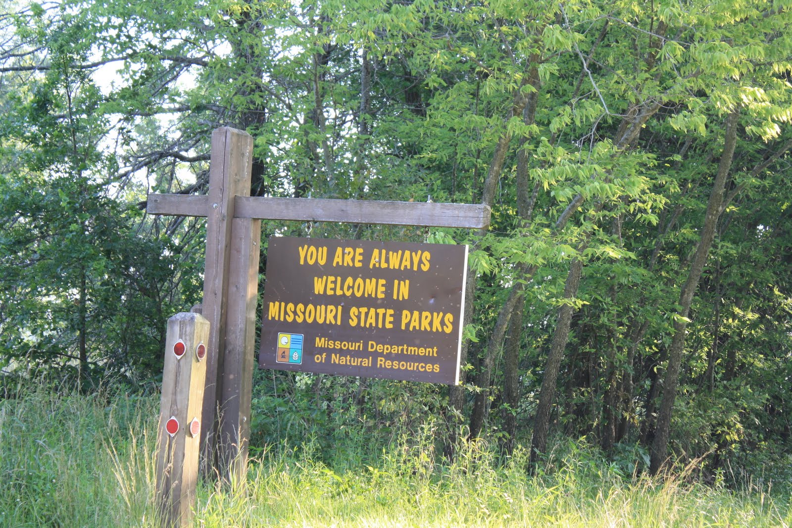
The first stop will be St. Louis. I planned on stopping in Hannibal, MO to visit the Mark Twain Museum, the Arch and the spot where the Missouri River joins the Mississippi. As you may recall I went to the headwaters of the Missouri in Montana, so I want to see how it ends since I saw how it begins and I have seen it a couple of times in the middle as well.


I had a nice father's day and went to say goodbye to the family. My starting time was 6:00 AM on a bright warm morning. For the first four days I think it was 80% by 10 AM. The weather in Kansas was brutal but has been nicer since getting to Colorado and New Mexico.


Thank you for your help in keeping off the rain last night. Hardly a drop fell. I had some rain today, but and it looked threatening as I was drawing close to my Kampground just north of Albuquerque this evening - but it has cleared-up nicely with a little breeze to keep the skeeters away. Lets hope it remains so for the rest of the trip.


I now have made it all the way to Gallup, NM so I need to get caught up on the blog. Three days camping in the tent and no rain - on me anyway - which is the way I like it. Let it rain for the next 2 nights as I am in a motel. The clerk had to double check my reservation as they are charging $125 plus per night and on the Internet I got $58 per night. Planning ahead worked.


And away we go...


Meet me in St. Louis, Louie.


Interstate 70 goes directly to St. Louis from Indy and is 243 miles away. Aliens must be abducting me on all my drives because it never takes the allotted time. It should take only 3.5 hours to get to St. Lou at 70 miles an hour. I do understand why it takes twice as long - every time to get to my destination. I guess this is where not wearing a watch thing takes its toll on my travel time.


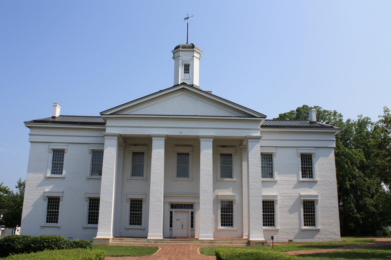
First stop St. Lou, er a Vandalia, IL. Saw a billboard along the way pointing out the that there is a Lincoln factor to Vandalia, IL. It just so happens that Vandalia was the second State Capital of Illinois during the time of Lincoln's first and second terms of the Legislature. I knew there was a good reason why it takes so long to get anywhere - there is a lot of cool places to stop and neat things to do everywhere I look.


Vandalia, IL is a sleepy town. The local populace at the time paid for a new State Building in hopes of keeping the Capital in their fine metropolis. No such luck. I guess Springfield had better lobbyists. :) The fair citizens replaced a leaky second Capitol building with a nice third Capitol Building to no avail. The Legislature quickly moved the arguments to Springfield. Maybe it was the moving companies that had the better lobby.


Slavery reared its ugly head in Lincoln's second term in Vandalia. The Illinois Legislature passed a resolution to tell the Federal Government to keep its votes out of the slavery question in the District of Columbia. It seems that the House started discussing removing slavery from the Nation's Capitol with out the consent of the people. Illinois did not like that. Their resolution included the provision that the Governor was to send the resolution to Mississippi, Virginia, Alabama, New Your and Connecticut. Interesting mix of States.


Since 2009 was the 200Th anniversary of Lincoln's birth, the current Illinois created a standard set of historical markers with disks that people can make a rubbing of to keep in a journal. A nice idea. They call the overall campaign "Looking for Lincoln" and the rubbing has a picture of something that matches the written sign boards. A nice idea. I wonder how many kids were dragged to these sites to make rubbings and learn about Lincoln and how many will find those journals 10 years later and profess to have liked the trips. :)


The Vandalia Capitol Building was built on the Cumberland Road. This is the same road that Lincoln lived on as a boy in Kentucky when he lived, and almost drowned, in Knob Creek. Small world. I wonder if he realized that or not.


Across the street from the Capitol Building is a park and was an area that Lincoln would sit and think and I am sure get into debates over one topic or another. The town has commissioned and placed a bronze statue of Lincoln reading the newspaper. One of the nicer statues of Lincoln that I have seen. I like it that it is not some frozen facial expression of him standing or sitting. This is a nice personal rendition of Abe, I especially like the hat. See Dave, I told you I should have bought the Stove Pipe hat in Springfield.


Off we go to St. Louis, Hannibal, MO really - forever behind schedule.


Going to Hannibal, Mo to see the boyhood home of Mark Twain. It was faster to go to St. Lou first as I70 goes directly at an angle across Illinois, across the thinnest part of the state. Then it is up to Hannibal on a state Highway. But first - a stop in Collinsville, IL for a quick picture of the World's Largest Catsup Bottle. Unfortunately it is on private property so I could not get very close and it was on a hill so it was difficult to find a safe place to get a view for the picture.


It was not so quick of a stop as that pesky Reinvest in America money was around tearing up roads and making detours. More on that later as well. But I found the bottle and have a wonderful memento of Southern Illinois.


Off to Hannibal, MO. Across the mighty Mississippi river and take a right to go up the river to Hannibal. I decided to pass up the scenic route along the river thinking if there was enough time after the visit to Mark's place, I would scenic it back to St. Lou.


The City Fathers, or maybe the City Parents, have kept the old part of Hannibal like it was when Mark Twain lived there under the alias of Samuel Langhorne Clemens. Sam only lived in Hannibal until he was 17 and never returned after that - but you can not tell that from the Hannibal of today.


Hannibal has an okay museum. They tell the story of the writings of Twain, but the only artifact is a desk that he once used and a dresser. They did have impersonator talk for about 45 minutes. He seemed to be answer the questions asked of him, but you could not tell which ones he made up. He tool Twain's humor to the max and made stuff up if he did not know. Kinda cute.


Twain's boyhood home does not have any written information to describe what you are seeing. I was not sure if the furniture and clothes were original family, reproductions or original period. Not put together very well. They should talk to the Spam Museum people to find out how a real museum is set-up.


They have a Lighthouse that was is on the location of a family that Twain wrote about. It has about 250 stairs to climb to get to the top. Thinking that there would be a great view from that high up, I walked every step sometimes two at a time thinking that it was hot and humid anyway, I might as well get up as quickly as possible. Great climb but no pay off. Someone forgot to schedule the tree trimming so you climb all the way up to get a view of - leaves. oooo, if looks could kill, the Director of Public Works for the City of Hannibal, MO would have dropped dead in his tracks.


The picture shows just the last flight of four to get from the town up to the light house. Maybe it was more like 400 stairs. I just know Tom Sawyer would have had some one else walk up and take the picture for him...


The best view of the Twain Hannibal, MO and the river turned out to be from Lover's Leap. Interesting story of how it got its name. An Indian Brave and Princess were forbidden to see each other. But just like today's youth, they did not mind their elders. They were discovered and the Brave was being attacked. They didn't want to be apart so they jumped to their deaths to be together. How Montague and Capulet of them. Do you think Shakespeare heard the story and copied it?


If you look near the top of the picture you can see the Lighthouse with the base behind the trees. So much for climbing the 500 stairs in such heat and humidity that it wilted the flowers as they bloomed.


Off to St. Lou via the scenic route. Except that a third of the way down it turns out there is a bridge that is out so you have to take a detour so I wound up back on the road I took to get to Hannibal. It just took and extra 30 minutes to go via the scenic route. Thanks to the Missouri Director of Transportation, I did not find out about the bridge until I was so close it was too late to take any other way. Good thing I do not have much of a time table. Who needs sleep.


Finally got to the Kampground before dark, signed in and took off for downtown to the Arch. I was hoping that the tickets were not sold out since they go up until 9 something every night. But alas, no such luck. This is one of the few problems I have - not being able to sign-up for tickets on the Internet because I am not sure what time I am going to get to a certain place. And, I do not want to be tied to a schedule. It has been way more fun to go and stop when it appears interesting to do so.


The Arch is cool up close. I have passed through St. Louis in the past and have seen it from a distance, but never up close. The picture in the daylight came out much better than the one after dark.


The arch was designed as part of a competition to develop some sort of marker for the start of the Lewis and Clark expedition. When the Arch design was selected, no one knew how to build it. Obviously they determined how to do it. The story of how it was built is interesting. It is built in triangle shaped pieces of aluminum over a graphite steel infrastructure. They have trains running up both legs of the arch. The reason I did not get a ticket is that only one leg was in operation, the other was closed due to a small crowd.


Underneath the plaza where you go to catch the train to the top is a museum to the Lewis and Clark expedition. They show 2 IMAX movies, one on the building of the Arch and the other on the Lewis and Clark expedition. Since I have seen many of the places where they stopped for dinner, I chose the Lewis and Clark expedition.


A couple of interesting points of the expedition. Lewis took his Newfoundland Hound on the expedition. The dog made it the whole way. I think that having the dog make it the whole way and back is amazing. Thinking of all the ways he could have been injured - or worse - I would have bet against the dog making it - snakes, bears, protecting his owner, freezing temperatures, etc. Just amazing.


Only 1 man lost his life and they think that was from a burst appendix and two Blackfeet Indians were killed in a skirmish on the return trip. The trip to the coast took 18 months, but due to Clark's maps, it only took 5 months to return to St. Louis. And finally, Lewis slipped and slid down the side of a mountain barely catching a tree to stop from falling a couple of hundred feet into the river. It was only the third day and the expedition would have been over before it started.


Two quotes are included from the museum. The first is Lewis' comments about the Great Falls that we saw in Montana. And the second is from Tecumseh, the Indian Chief which I think that many Indians still believe today.


Two blocks away from the Arch is the Federal Court House where the Dred Scout case began its process through the courts. This decision on Slavery and Freemen was one of the reasons for the Civil War. Not a great picture, but it was very dark and I was too tired to walk closer.

Sorry but the final two pictures are out of order. I had to include the Catsup bottle. Putting me that far behind schedule demands a place in the blog. Somehow the original desk of Mark Twain's was not included in the proper place. I guess I need to double check my picture insertion.


Tthanks for comng along with me. The next stop is Lawrence, Kansas just the other side of Kansas City, MO.


Michael